


BAOR:ROYAL ENGINEERS BATTLEFIELD TOUR – NORMANDY TO THE SEINE
Price range: £19.99 through £35.00
This is the first volume in the highly regarded ‘Engineers Battlefields Tour’ set of three volumes, all of which have now been reprinted by N&MP. they are complete with all the excellent GSGS cartography from the original 1946 editions.
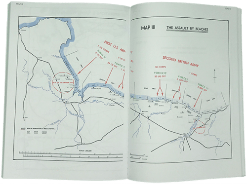
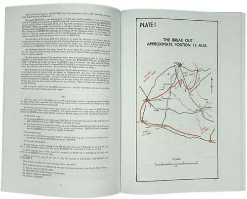
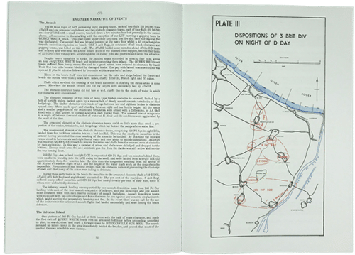
This volume gives details of all operations by the Royal Engineers during D-Day and up to the Seine crossing at Vernon. It covers I Corp’s plans for the assault, operations of 6 Airborne Division, the assault by 3 British Division, bridging the Caen Canal and the River Orne, the construction of airfields in France, the capture of Le Havre and the Seine crossing at Vernon. There are many maps and photographs in the book which enhance the experience of reading this account.
Description
Prepared in 1946, this volume was designed for succeeding generations of Royal Engineers who would visit the battlefields of Europe after the war. Its purpose was to demonstrate the problems faced by the Royal Engineers in the major campaigns of the Second World War and the problems they used to solve them. The operations chosen for inclusion in this tour were done so because they were regarded as typical examples of engineering tasks.
What was Geographical Section, General Staff (GSGS)?
Geographical Section, General Staff (GSGS, also known as MI 4) operated under the Director of Military Operations and Intelligence. Its role was to supply maps to the forces, collect data on foreign survey networks, provide training, and prepare survey data for Expeditionary Force mobilisation.
GSGS was organised into small sections, each of which specialised in maps of a particular region. The War Office Map Library, which was also part of MI 4, acquired maps and cartographic intelligence data.
Senior staff members were usually Royal Engineer officers with surveying qualifications, although there were a few Royal Artillery or infantry officers. The rest of the staff were civil technical assistants and clerks, together with some Royal Engineer other ranks.
Additional information
| Author/Editor | Prepared under the direction of the Chief Engineer, British Army of the Rhine |
|---|---|
| Product Code | 28734 |
| Delivery | Usually despatched within 14 Days |
| Format | 2020 N&M Press reprint (original pub 1946). Sxviii+217 pages with 49 photographs and 14 multi page colour maps & 31 full page colour maps |
| ISBN | 9781783317516 |
You may also like…