
NATIONAL ARCHIVES BRITISH TRENCH MAP ATLAS THE WESTERN FRONT 1914-18. VOLUME 2 SPECIAL SHEETS
Original price was: £145.00.£19.99Current price is: £19.99.
Trench Maps ‘special sheets’ demonstrate that the First World War was not a simple matter of ‘lions led by donkeys’, but involved a massive amount of methodical and advanced scientific work – intelligence, aerial photography, photogrammetry, sound-ranging, predicted fire, aeroplanes, tanks, chemical, etc. – in an attempt to reduce casualties and break the deadlock.
In stock
Description
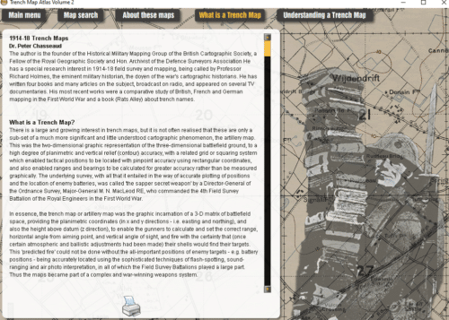
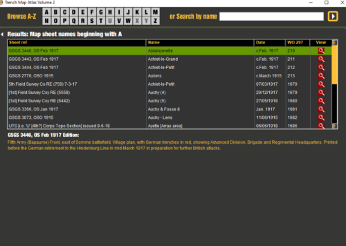
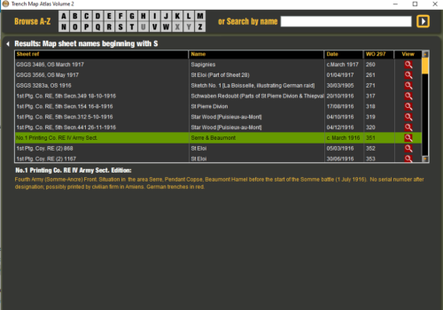
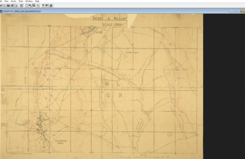
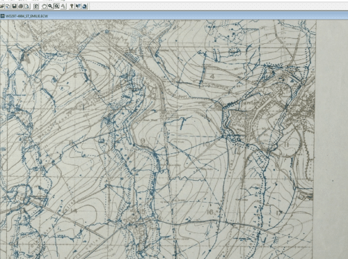
This DVD ROM includes over 750 ‘special sheets’ with expert commentary, at the 1:5,000, 1:10,000 and 1:20,000 scales from the ‘special sheets’ collection held at The National Archives in TNA Class WO 297. The main battles and many smaller ‘actions’ are well-represented, with maps showing trench systems developing over time, and the progress of battles – Loos, Somme, Arras, Vimy Ridge, Messines, Third Ypres, Hindenburg Line, Amiens, etc.
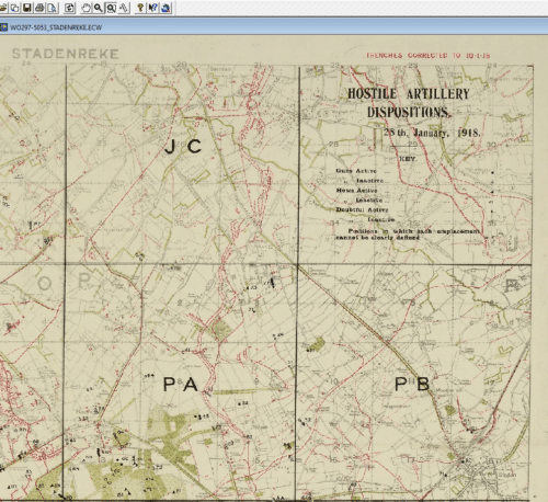
Trench maps were used as a background for overprinting the specific functional information (e.g. Barrage Maps) of many of the ‘special sheets’. Particularly important overprints show artillery and intelligence functions, notably ‘Barrage Maps’ for attacks, and ‘Enemy Order of Battle’ and ‘Distribution of Enemy Forces’ maps distributed for operations. ‘Hostile Battery Positions’ maps show enemy artillery batteries located by flash-spotting, sound-ranging, aerial photography and reconnaissance, etc., and ‘Harassing Fire’ maps show artillery targets in the enemy area to be subject to interdiction fire.
Price + VAT (VAT is applicable to all UK orders)
Additional information
| Author/Editor | Edited by Peter Chasseaud |
|---|---|
| Product Code | DVD04 |
| Delivery | Usually despatched Same Day |
| Format | DVD ROM over 750 ‘special sheets’ with expert commentary |
| ISBN | 9781783311361 |
You may also like…